

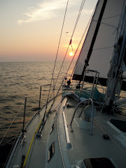
Hey guys, we saw two things coming from Oxford to Solomons Island, Maryland that we thought might pique your interest. You may have to enlarge them on your computer to get a better view.
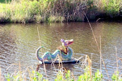
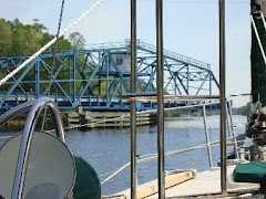
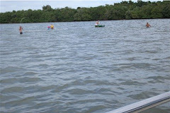
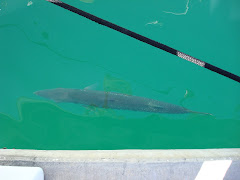
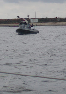
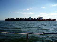
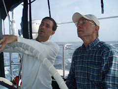
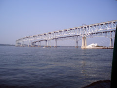
Can anyone guess what photo one, on the left, or photo two, on the right, is?
Have you looked at a map to see if you can locate were we are on our boat? Try finding the Patuxent River and Solomons Island, Maryland. Hint -- it's on the western side of the Chesapeake Bay south of Annapolis.
Over the next week we will be sailing to Norfolk, Virginia. Try finding it on your map. The Intracoastal Waterway starts at Norfolk and goes all the way to Florida. It will take us about a month to reach Florida by boat. Flying or driving is much faster!


3 comments:
It will be easier to look on the western shore to find Solomons Island and the Patuxent River. Don't miss the Calvert museum in Solomons, not to mention the beautiful fire hydrants. Judging by the first photo it looks like you had some nice breeze.
Kit finally found Solomon's Island on the map when he got finished being angry about our new atlas going directly from Rhode Island to South Carolina. It rudely skipped right over the Sol's! And believe me, someone was going to pay! (That would be me.) ;o( Things got much cheerier once he calmed down enough for me to convince him that Solomon's Island was in Maryland. (By the way, didn't you just read that to me from the website, Kit? Yes, I thought so!) Now he's pretty excited & wants to know how far you have sailed, how far in Florida are you going? Are you going to stop & see us? Will you continue around Florida to Mobile? If so, can we meet you there?...... Inquiring minds NEED to know!! But, I'm sure you cannot relate to that.
The pictures didn't pull a lot of interest. They kept asking where your boat was in the pictures. Their only guess was an oil rig for the second one. I didn't say anything to them, but the first one looked like the description of the fence they built across the bay to catch the great white shark that was attacking people all up the eastern seaboard a long time ago. (The story 'Jaws' was based on. I just find it hard to believe it is still there.)
We have been enjoying reading about your excursions. I'm glad to hear about the lower laundromat rates. When I read the Maine rates, I wondered if I could ever afford to wash my horse blankets again.
The picture on the left is a fish haven; the one on the right is an offshore oil delivery terminal - good guesses!
We don't know how far we are going to sail south - but will keep you posted as we go.
Haven't kept track of how many miles we've come - but it's been a long way!
Post a Comment