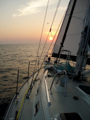
The NOAA forecast this morning was 15-20 knots from the west, seas 2-3 feet, with a small craft advisory in effect along the Atlantic coast and throughout the Chesapeake Bay. It was such a beautiful sunny Saturday morning, much too nice to stay at the dock; we set our course for the Great Wicomico River 40 plus miles south. We left Patuxent Naval Base at 9:30AM, looking forward to a brisk beam reach with 15 knot winds.
It’s 11AM and the only waves on the bay are from motorboats. The wind is 2-3 knots from the north. We are in the company of many other sailboats, all motoring south under bare poles.
Bob is staying marginally entertained dodging a few crab pots. The multitudes of lobster pots in Casco Bay, Maine require much more vigilance.
On the way down today we saw a number of pelicans. A couple we met in Oxford told us pelicans, who used to be endangered, are now migrating in numbers farther north each year.
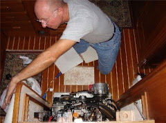
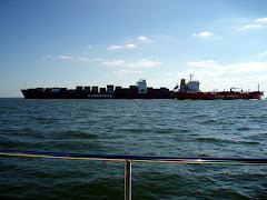
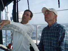
Bob loves watching the chartplotter screen and playing with the electronic settings in the cockpit, sometimes to the detriment of watching what is happening in reality around him. This morning he had his manuals out and was totally focused on adjusting something on the screen. As I came up from the galley, he had a perplexed look on his face. I asked, “What are you trying to do?” He replied, “There’s a fixed object up there that looks like a tower or lighthouse ahead and I can’t find it on the chartplotter.” I picked up the binoculars and scanned the horizon for his fixed object – and found a huge barge being pushed by a tugboat about 3 miles off our bow.” He replied with his sense of humor, “I’m not talking anymore.”
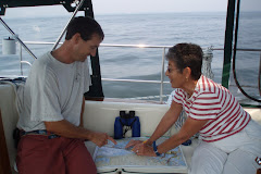
We anchored in a pristine rural area, Mill Creek, at 4:15PM. We found this beautiful spot in one of the many charts and books that Will and Halcyon Blake so generously loaned us for the trip,“Skipper Bob’s Anchorages Along the ICW.”
Three other travelers, “Argonauta” from Charlotte, VT, and “Marie Gallante II” and “Epsilon” both from Montreal have found this anchorage as well. In the morning I'll try to contact “Agronauta.” Their hailing port is on Lake Champlain across from Essex, New York. We often anchored in Converse Bay, just south of Charlotte.
We have two neat electronic aids to help us sleep confident that the anchor is holding: the chartplotter’s GPS keeps track of the boat’s position and sounds an alarm if it goes beyond the expected swinging circle around the anchor; and the “boat track” feature of the chartplotter puts a red dot on the screen every two minutes, so we can glance at the screen now and then and see that we’re still inside the swinging circle. Ain’t technology wonderful???
Subscribe to:
Post Comments (Atom)


1 comment:
Hello there Hollie and Bob, great Blog, looking forward to comparing notes as we go! Happy trails.
Post a Comment